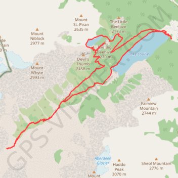
Lake Louise - Plain of 6 Glaciers - Lake Agnes
Interactive map
GPS track profile
About this GPS track
Name: Lake Louise - Plain of 6 Glaciers - Lake Agnes GPS track, route, trail
Start: Lac Louise, Division No. 15, Alberta, Canada (51.41540 -116.21501)
End: Lac Louise, Division No. 15, Alberta, Canada (51.41542 -116.21505)
Coordinates: 51.38631 -116.28505 51.41798 -116.21499
Other GPS tracks
Click on a GPS track to view route, its statistics and profile.