GPS tracks, routes, trails, hikes

GPS tracks visualization and sharing, free and without registration.

Import a GPX file

Valley of the 5 Lakes

Jasper National Park. #Hike #Loop #Jasper

  • Distance: 12.0 mi
  • Elevation gain: 1,490 ft
  • Maximum elevation: 3,825 ft
  • Elevation loss: 1,512 ft
  • Minimum elevation: 3,396 ft

Interactive map

GPS track profile

About this GPS track

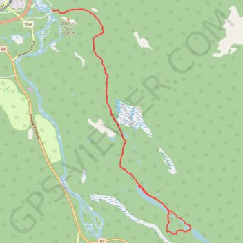
Name: Valley of the 5 Lakes GPS track, route, trail.
Start: Valley of the 5 Lakes Trail, Municipality of Jasper, Alberta, T0E 1E0, Canada (52.87111 -118.06098)
End: Old Fort Point Road, Municipality of Jasper, Alberta, T0E 1E0, Canada (52.87134 -118.06226)
Coordinates: 52.81370 -118.06226 52.87158 -118.00303

Other GPS tracks

Jasper - Jasper National Park

Canada > Alberta > Municipality of Jasper

#Bike #Jasper

Distance: 51.3 mi - Elevation gain: 3,140 ft - Maximum elevation: 5,253 ft - Coordinates: 52.34411 -118.07750 52.85045 -117.33877

Start: Whistler Campground, Icefields Parkway, Municipality of Jasper, Alberta, T0E 1E0, Canada (52.85045 -118.07742)

End: HI Beauty Creek, Icefields Parkway, Alberta, Canada (52.34411 -117.33877)