Denver Zoo
- Distance: 0.7 mi
- Elevation gain: 23 ft
- Maximum elevation: 5,292 ft
- Elevation loss: 23 ft
- Minimum elevation: 5,266 ft
Interactive map
GPS track profile
About this GPS track
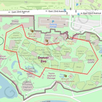
Name: Denver Zoo GPS track, route, trail
Coordinates: 39.74850 -104.95254 39.75068 -104.94744
Topography: Denver topographic map