Linear Trail
Interactive map
GPS track profile
About this GPS track
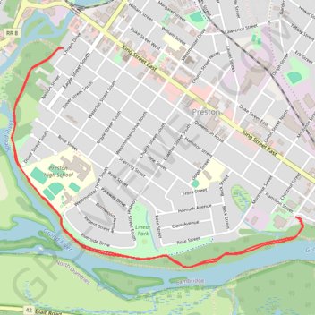
Name: Linear Trail GPS track, route, trail
Coordinates: 43.38525 -80.37052 43.39757 -80.34800
Other GPS tracks
Click on a GPS track to view route, its statistics and profile.
Aldershot - Kitchener
Canada > Ontario > Halton Region > Burlington
#Bike
Distance: 49.1 mi • Elevation gain: 1,870 ft • Maximum elevation: 1,135 ft