Rillington - Sherburn
Via The Wolds Way #Hike
- Distance: 9.7 mi
- Elevation gain: 771 ft
- Maximum elevation: 594 ft
- Elevation loss: 748 ft
- Minimum elevation: 112 ft
Interactive map
GPS track profile
About this GPS track
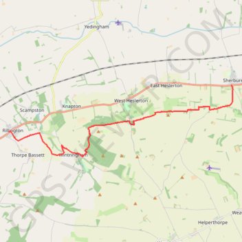
Name: Rillington - Sherburn GPS track, route, trail
End: Sherburn, North Yorkshire, England, YO17 8QQ, United Kingdom (54.17762 -0.53283)
Coordinates: 54.14697 -0.69611 54.17762 -0.53203