Sugarloaf Reservoir Park
Interactive map
GPS track profile
About this GPS track
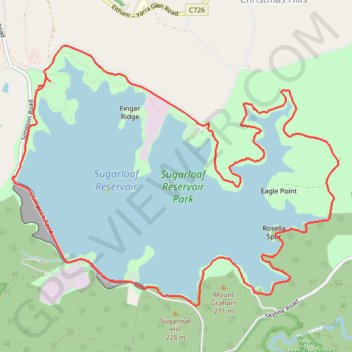
Name: Sugarloaf Reservoir Park GPS track, route, trail
Coordinates: -37.68317 145.28809 -37.65744 145.32871
Other GPS tracks
Click on a GPS track to view route, its statistics and profile.
Tallarook - Eildon - Hurstbridge
Australia > Victoria > Tallarook
#Bike
Distance: 173.2 mi • Elevation gain: 16,066 ft • Maximum elevation: 2,848 ft