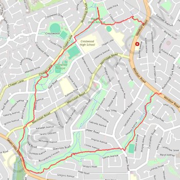
Sophia Doyle Reserve
#Hike #Loop #SophiaDoyle #Sydney
- Distance: 4.2 mi
- Elevation gain: 171 ft
- Maximum elevation: 364 ft
- Elevation loss: 249 ft
- Minimum elevation: 167 ft
Interactive map
GPS track profile
About this GPS track
Name: Sophia Doyle Reserve GPS track, route, trail
Coordinates: -33.75999 150.96488 -33.73917 150.98641
Other GPS tracks
Click on a GPS track to view route, its statistics and profile.
Perth to Sydney
Australie > Australie occidentale > City of Belmont
Distance: 2,362.0 mi • Elevation gain: 47,762 ft • Maximum elevation: 3,802 ft