Canberra - Lake Burley Griffin
Interactive map
GPS track profile
About this GPS track
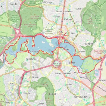
Name: Canberra - Lake Burley Griffin GPS track, route, trail
Coordinates: -35.31638 149.07072 -35.28216 149.17117
Other GPS tracks
Click on a GPS track to view route, its statistics and profile.
Cloudride24.FINAL
Distance: 639.3 mi • Elevation gain: 69,823 ft • Maximum elevation: 5,755 ft