GPS tracks, routes, trails, hikes

GPS tracks visualization and sharing, free and without registration.

Import a GPX file

Rainbow Beach - Double Island Point

Great Sandy National Park. #MTB #Loop #Sandy

  • Distance: 27.6 mi
  • Elevation gain: 2,408 ft
  • Maximum elevation: 666 ft
  • Elevation loss: 2,402 ft
  • Minimum elevation: 0 ft

Interactive map

GPS track profile

About this GPS track

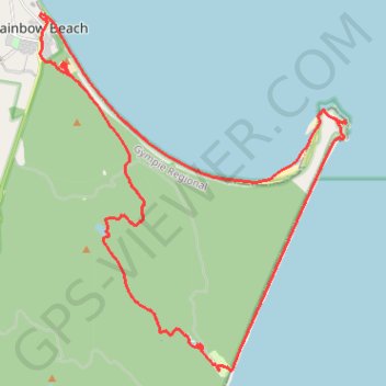
Name: Rainbow Beach - Double Island Point GPS track, route, trail.
Start: FoodWorks, 4, Rainbow Beach Road, Rainbow Beach, Gympie Regional, Queensland, 4581, Australia (-25.90188 153.09195)
End: FoodWorks, 4, Rainbow Beach Road, Rainbow Beach, Gympie Regional, Queensland, 4581, Australia (-25.90196 153.09192)
Coordinates: -26.00561 153.08975 -25.89975 153.19070

Other GPS tracks

Cooloola Great Walk

Australia > Queensland

Great Sandy National Park. #Hike #Sandy

Distance: 54.7 mi - Elevation gain: 6,329 ft - Maximum elevation: 699 ft - Coordinates: -26.32993 153.04349 -25.90253 153.14952

Start: Cooloola Great Walk, Noosa North Shore, Noosa Shire, Queensland, 4565, Australia (-26.32992 153.06053)

End: Phil Rogers Park, Wide Bay Esplanade, Rainbow Beach, Gympie Regional, Queensland, 4581, Australia (-25.90253 153.09277)