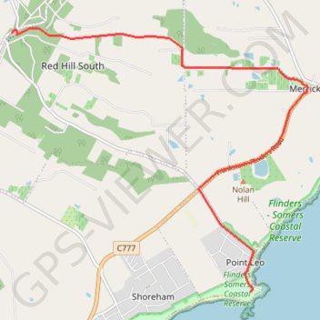
Point Leo - Red Hill South
#Hike
- Distance: 7.3 mi
- Elevation gain: 761 ft
- Maximum elevation: 650 ft
- Elevation loss: 187 ft
- Minimum elevation: 36 ft
Interactive map
GPS track profile
About this GPS track
Name: Point Leo - Red Hill South GPS track, route, trail
Start: Point Leo, Melbourne, Shire of Mornington Peninsula, Victoria, 3916, Australia (-38.42391 145.07653)
Coordinates: -38.42391 145.02529 -38.37966 145.08880
Other GPS tracks
Click on a GPS track to view route, its statistics and profile.