Los Silos-Los Ejos - Los Silos
Interactive map
GPS track profile
About this GPS track
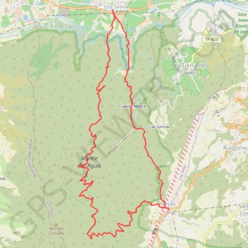
Name: Los Silos-Los Ejos - Los Silos GPS track, route, trail
Coordinates: 28.32225 -16.82427 28.36526 -16.80498
Other GPS tracks
Click on a GPS track to view route, its statistics and profile.
Tenerife - Forêts vierges embrumées du Monte Del Agua
Randonnée depuis Erjos. #Randonnée
Distance: 7.1 mi • Elevation gain: 1,529 ft • Maximum elevation: 3,373 ft