Munro sans nom entre carn eige et mam sodhail
Randonnée pédestre. En aller-retour. #Randonnée
- Distance: 13.7 mi
- Elevation gain: 3,258 ft
- Maximum elevation: 3,829 ft
- Elevation loss: 3,258 ft
- Minimum elevation: 764 ft
- Moving time: 6 h 27 m
- Moving speed: 2.1 mph
- Maximum speed: 4.3 mph
- Total time: 7 h 7 m
- Global speed: 1.9 mph
- Date: 08/06/2010
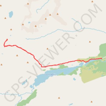
Interactive map
GPS track profile
About this GPS track
Name: Munro sans nom entre carn eige et mam sodhail GPS track, route, trail
Start: River Affric, Glen Affric Road, Highland, Écosse, Royaume-Uni (57.26493 -4.98568)
End: River Affric, Glen Affric Road, Highland, Écosse, Royaume-Uni (57.26492 -4.98561)
Coordinates: 57.25853 -5.12530 57.28001 -4.98559
Other GPS tracks
Click on a GPS track to view route, its statistics and profile.
Glen Affric
Royaume-Uni > Écosse > Highland
Distance: 10.9 mi • Elevation gain: 1,017 ft • Maximum elevation: 1,056 ft