Quebec - La Yourte
Randonnée pédestre. Depuis Saint-Raymond. #Randonnée
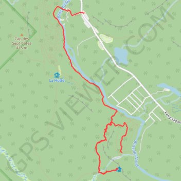
- Distance: 4.4 mi
- Elevation gain: 1,004 ft
- Maximum elevation: 1,411 ft
- Elevation loss: 1,010 ft
- Minimum elevation: 653 ft
Interactive map
GPS track profile
About this GPS track
Name: Quebec - La Yourte GPS track, route, trail
Coordinates: 47.04998 -71.89725 47.07560 -71.88066
Other GPS tracks
Click on a GPS track to view route, its statistics and profile.
Québec - Chute Delaney
Canada > Québec > Portneuf (MRC) > Saint-Raymond
Randonnée en aller-retour depuis Saint-Raymond. #Randonnée
Distance: 4.9 mi • Elevation gain: 420 ft • Maximum elevation: 761 ft