Scafell Pike
Randonnée pédestre. En aller-retour. #Randonnée
- Distance: 5.3 mi
- Elevation gain: 2,943 ft
- Maximum elevation: 3,182 ft
- Elevation loss: 2,943 ft
- Minimum elevation: 236 ft
- Moving time: 3 h 37 m
- Moving speed: 1.5 mph
- Maximum speed: 4.0 mph
- Total time: 4 h 20 m
- Global speed: 1.2 mph
- Date: 06/10/2014
Interactive map
GPS track profile
About this GPS track
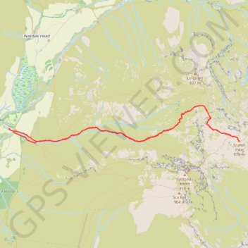
Name: Scafell Pike GPS track, route, trail
Coordinates: 54.45392 -3.26225 54.45874 -3.21156