Boucle panoramique Santa Maria Navarrese
Interactive map
GPS track profile
About this GPS track
Name: Boucle panoramique Santa Maria Navarrese GPS track, route, trail
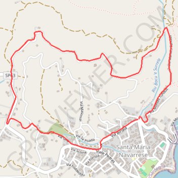
Start: Santa Maria Navarrese, Baunei, Nuoro, Sardaigne, 08040, Italie (39.99206 9.68778)
End: Santa Maria Navarrese, Baunei, Nuoro, Sardaigne, 08040, Italie (39.99211 9.68788)
Coordinates: 39.98975 9.67475 39.99901 9.69105
Other GPS tracks
Click on a GPS track to view route, its statistics and profile.
1 LUCENA - MONTPELLIER
Distance: 1,842.0 mi • Elevation gain: 96,785 ft • Maximum elevation: 3,438 ft
1 LUCENA - MONTPELLIER
Espagne > Andalousie > Lucena
Distance: 1,842.0 mi • Elevation gain: 96,785 ft • Maximum elevation: 3,438 ft