Le chemin de fer des japonais - Pont-Gauzère
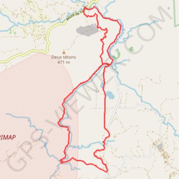
Interactive map
GPS track profile
About this GPS track
Name: Le chemin de fer des japonais - Pont-Gauzère GPS track, route, trail
End: Route de Yaté, Mont Dore, Province Sud, Nouvelle-Calédonie, France (-22.18708 166.72147)
Coordinates: -22.24749 166.71073 -22.18701 166.73549
Other GPS tracks
Click on a GPS track to view route, its statistics and profile.
UTNC 80 km
France > Province Sud > Mont Dore
Distance: 50.6 mi • Elevation gain: 10,679 ft • Maximum elevation: 1,955 ft
Bcl chemin japonais-bois du sud
France > Province Sud > Mont Dore
Mont Dore
Distance: 10.6 mi • Elevation gain: 2,060 ft • Maximum elevation: 1,949 ft
Le chemin de fer des japonais - Pont-Gauzère
France > Province Sud > Mont Dore
Distance: 13.6 mi • Elevation gain: 1,601 ft • Maximum elevation: 656 ft