Mount Coot-tha Loop
Interactive map
GPS track profile
About this GPS track
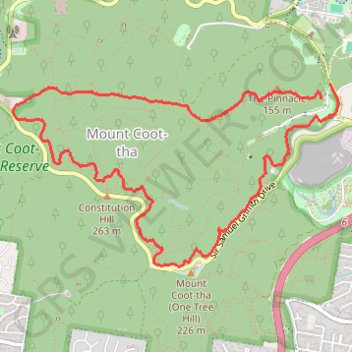
Name: Mount Coot-tha Loop GPS track, route, trail
Start: Pinnacle Track, Mount Coot-tha, Greater Brisbane, Queensland, 4066, Australia (-27.47161 152.97034)
Coordinates: -27.48459 152.94343 -27.47048 152.97183
Other GPS tracks
Click on a GPS track to view route, its statistics and profile.
Brisbane Trail Run
Australia > Queensland > Brisbane City
Mount Coot-Tha MTB trails
Distance: 4.9 mi • Elevation gain: 896 ft • Maximum elevation: 735 ft