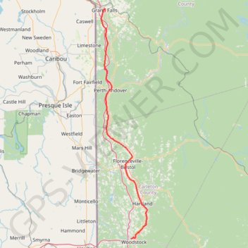
Grand Falls - Woodstock
- Distance: 73.7 mi
- Elevation gain: 3,002 ft
- Maximum elevation: 728 ft
- Elevation loss: 3,173 ft
- Minimum elevation: 128 ft
Interactive map
GPS track profile
About this GPS track
Name: Grand Falls - Woodstock GPS track, route, trail
Coordinates: 46.16276 -67.75792 47.04918 -67.49733
Other GPS tracks
Click on a GPS track to view route, its statistics and profile.
Woodstock - Upper Kingsclear
Canada > New Brunswick > Woodstock Parish > Woodstock
Saint John River. #Bike #Woodstock #UpperKingsclear #SaintJohn
Distance: 47.9 mi • Elevation gain: 1,929 ft • Maximum elevation: 328 ft
Edmundston - Grand Falls
Canada > New Brunswick > Edmundston
Distance: 44.7 mi • Elevation gain: 1,138 ft • Maximum elevation: 564 ft