Import a GPX file

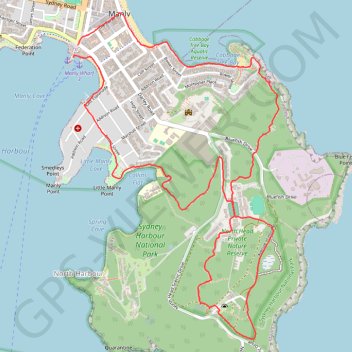
North Head via Blue Fish Track

Sydney Harbour National Park. #Hike #Loop #Sydney

  • Distance: 5.8 mi
  • Elevation gain: 584 ft
  • Maximum elevation: 331 ft
  • Elevation loss: 597 ft
  • Minimum elevation: 3 ft
  • Moving time: 2 h 2 m
  • Moving speed: 2.9 mph
  • Maximum speed: 4.9 mph
  • Total time: 2 h 7 m
  • Global speed: 2.7 mph
  • Date: 01/18/2020

Interactive map

GPS track profile

About this GPS track

Other GPS tracks

Click on a GPS track to view route, its statistics and profile.

Sydney Harbour National Park - Manly to Spit Bridge Walk

Australia > New South Wales > Sydney

#Hike #Sydney

Distance: 11.3 mi • Elevation gain: 1,585 ft • Maximum elevation: 322 ft

Manly to Spit Bridge Walk

Australia > New South Wales > Sydney

#Hike #Sydney

Distance: 6.7 mi • Elevation gain: 863 ft • Maximum elevation: 279 ft