East Coast Trail - Sugarloaf Path
- Distance: 5.2 mi
- Elevation gain: 1,467 ft
- Maximum elevation: 505 ft
- Elevation loss: 1,532 ft
- Minimum elevation: 7 ft
Interactive map
GPS track profile
About this GPS track
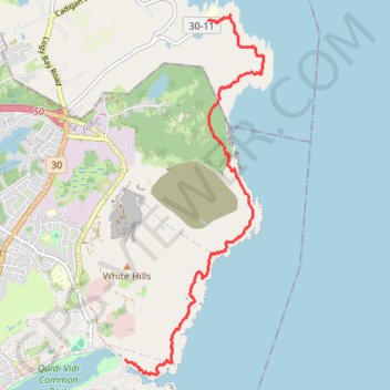
Name: East Coast Trail - Sugarloaf Path GPS track, route, trail
Coordinates: 47.58154 -52.67795 47.62452 -52.65340
Other GPS tracks
Click on a GPS track to view route, its statistics and profile.
St. Johns - Signal Hill - Quidi Vidi
Canada > Newfoundland and Labrador > St. John's
Signal Hill National Historic Site. #Hike #SignalHill #Atlantic
Distance: 3.7 mi • Elevation gain: 932 ft • Maximum elevation: 489 ft