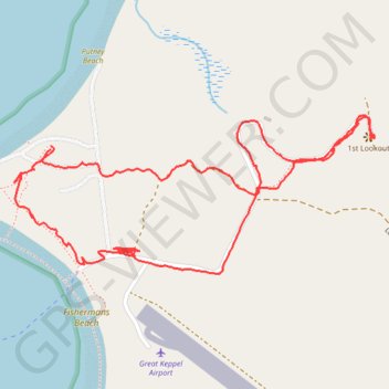
Mount Wyndham - Lighthouse
Great Keppel Island. #Hike #Loop #GreatKeppel
- Distance: 2.5 mi
- Elevation gain: 203 ft
- Maximum elevation: 194 ft
- Elevation loss: 203 ft
- Minimum elevation: 10 ft
- Moving time: 1 h 5 m
- Moving speed: 2.3 mph
- Maximum speed: 20.9 mph
- Total time: 1 h 9 m
- Global speed: 2.2 mph
- Date: 01/14/2020
Interactive map
GPS track profile
About this GPS track
Name: Mount Wyndham - Lighthouse GPS track, route, trail
Start: The Keppels, Livingstone Shire, Queensland, Australia (-23.17772 150.93542)
End: The Keppels, Livingstone Shire, Queensland, Australia (-23.17781 150.93541)
Coordinates: -23.18103 150.93439 -23.17692 150.94454