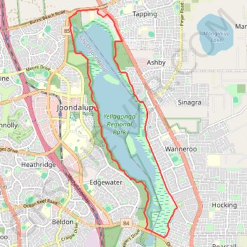
Lake Joondalup Circuit
Yellagonga Regional Park. #Hike #Bike #Loop #Yellagonga
- Distance: 11.1 mi
- Elevation gain: 453 ft
- Maximum elevation: 125 ft
- Elevation loss: 453 ft
- Minimum elevation: 59 ft
Interactive map
GPS track profile
About this GPS track
Name: Lake Joondalup Circuit GPS track, route, trail
Start: Boas Avenue, Joondalup, City Of Joondalup, Western Australia, 6027, Australia (-31.74328 115.77785)
End: Boas Avenue, Joondalup, City Of Joondalup, Western Australia, 6027, Australia (-31.74328 115.77785)
Coordinates: -31.77809 115.77036 -31.71711 115.80445
Other GPS tracks
Click on a GPS track to view route, its statistics and profile.
2021 Toodyay return via Kep
Distance: 142.9 mi • Elevation gain: 6,099 ft • Maximum elevation: 1,171 ft