Lac Viti - Lac Mývatn
- Distance: 11.2 mi
- Elevation gain: 659 ft
- Maximum elevation: 1,998 ft
- Elevation loss: 1,634 ft
- Minimum elevation: 922 ft
Interactive map
GPS track profile
About this GPS track
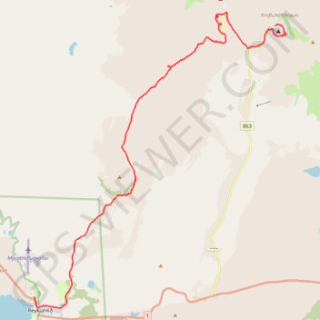
Name: Lac Viti - Lac Mývatn GPS track, route, trail
Start: Kröfluvegur, Þingeyjarsveit, Norðurland eystra, Islande (65.71841 -16.75536)
End: Reynihlíð, Reykjahlíð, Þingeyjarsveit, Norðurland eystra, Islande (65.64492 -16.91408)
Coordinates: 65.64194 -16.91408 65.72226 -16.74813
Other GPS tracks
Click on a GPS track to view route, its statistics and profile.
Lac Viti - Lac Mývatn
Distance: 11.2 mi • Elevation gain: 663 ft • Maximum elevation: 1,998 ft