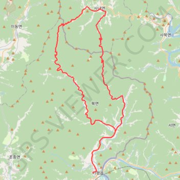
2023 가평자라섬그란폰도_메디오폰도코스
- Distance: 46.9 mi
- Elevation gain: 6,325 ft
- Maximum elevation: 3,383 ft
- Elevation loss: 6,280 ft
- Minimum elevation: 197 ft
Interactive map
GPS track profile
About this GPS track
Name: 2023 가평자라섬그란폰도_메디오폰도코스 GPS track, route, trail
Start: Munhwa-ro, Gapyeong, Gapyeong-gun, Gyeonggi, 12414, South Korea (37.82455 127.50794)
End: Gahwa-ro, Gapyeong-gun, Gyeonggi, 12403, South Korea (37.88509 127.54896)
Coordinates: 37.82455 127.43753 38.06678 127.56677
Topography: Gapyeong-gun topographic map