North Yuba River MTB Loop
Interactive map
GPS track profile
About this GPS track
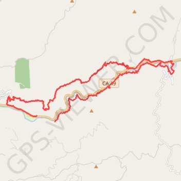
Name: North Yuba River MTB Loop GPS track, route, trail
End: CA 49, Goodyears Bar, Sierra County, California, 95944, United States (39.51383 -120.97626)
Coordinates: 39.51061 -120.99676 39.54314 -120.88427
Topography: Sierra County topographic map
Other GPS tracks
Click on a GPS track to view route, its statistics and profile.
Chester - Walker
États-Unis d'Amérique > Californie > Plumas County > Chester
Vélo. En aller simple entre Chester et Walker. #Vélo
Distance: 238.5 mi • Elevation gain: 19,974 ft • Maximum elevation: 8,337 ft