Braggin Rights to Long Distance Loop
- Distance: 5.4 mi
- Elevation gain: 965 ft
- Maximum elevation: 5,367 ft
- Elevation loss: 965 ft
- Minimum elevation: 4,619 ft
Interactive map
GPS track profile
About this GPS track
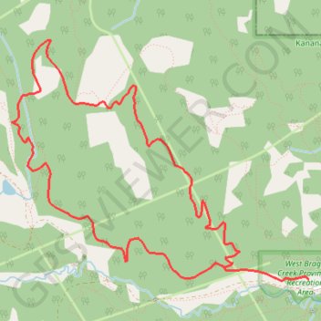
Name: Braggin Rights to Long Distance Loop GPS track, route, trail
Coordinates: 50.94832 -114.72560 50.96465 -114.69360
Topography: Division No. 15 topographic map
Other GPS tracks
Click on a GPS track to view route, its statistics and profile.
Braggin Rights to Long Distance Loop
Canada > Alberta > Division No. 15
West Bragg Creek Provincial Recreation Area. Kananaskis Country Public Land Use Zone. #Hike #MTB #Loop #WestBraggCreek #Kananaskis
Distance: 5.4 mi • Elevation gain: 965 ft • Maximum elevation: 5,367 ft