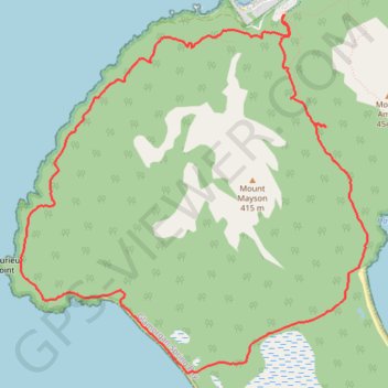
Mount Mayson Loop - Hazards Beach - Wineglass Bay Lookout - Coles Bay Lookout
- Distance: 7.2 mi
- Elevation gain: 1,093 ft
- Maximum elevation: 673 ft
- Elevation loss: 1,093 ft
- Minimum elevation: 0 ft
Interactive map
GPS track profile
About this GPS track
Name: Mount Mayson Loop - Hazards Beach - Wineglass Bay Lookout - Coles Bay Lookout GPS track, route, trail
Coordinates: -42.17411 148.26134 -42.14615 148.29786
Other GPS tracks
Click on a GPS track to view route, its statistics and profile.
Peninsula Track - Mount Freycinet
Distance: 18.9 mi • Elevation gain: 3,986 ft • Maximum elevation: 1,965 ft