Carboneras - Chinamada - mirador guaide
- Distance: 5.0 mi
- Elevation gain: 1,775 ft
- Maximum elevation: 2,329 ft
- Elevation loss: 1,775 ft
- Minimum elevation: 1,890 ft
Interactive map
GPS track profile
About this GPS track
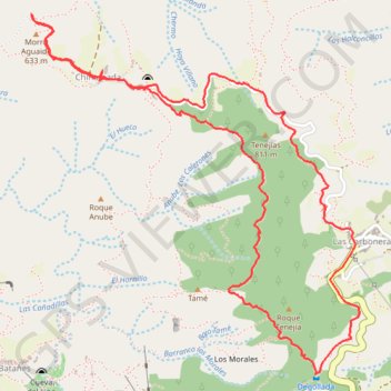
Name: Carboneras - Chinamada - mirador guaide GPS track, route, trail
Coordinates: 28.54743 -16.29481 28.56491 -16.27672
Other GPS tracks
Click on a GPS track to view route, its statistics and profile.
Punta del Hidalgo
Espagne > San Cristóbal de La Laguna
Sentier de Chinamada. #Randonnée
Distance: 2.8 mi • Elevation gain: 2,343 ft • Maximum elevation: 1,919 ft