Glen Affric
- Distance: 10.9 mi
- Elevation gain: 1,017 ft
- Maximum elevation: 1,056 ft
- Elevation loss: 1,017 ft
- Minimum elevation: 764 ft
Interactive map
GPS track profile
About this GPS track
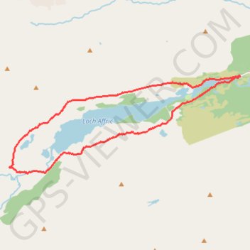
Name: Glen Affric GPS track, route, trail
Start: River Affric, Glen Affric Road, Highland, Écosse, Royaume-Uni (57.26503 -4.98442)
End: River Affric, Glen Affric Road, Highland, Écosse, Royaume-Uni (57.26503 -4.98453)
Coordinates: 57.23779 -5.10523 57.26550 -4.98442
Other GPS tracks
Click on a GPS track to view route, its statistics and profile.
Munro sans nom entre carn eige et mam sodhail
Royaume-Uni > Écosse > Highland
Randonnée pédestre. En aller-retour. #Randonnée
Distance: 13.7 mi • Elevation gain: 3,258 ft • Maximum elevation: 3,829 ft