Gloria Falls
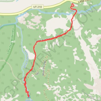
Interactive map
GPS track profile
About this GPS track
Name: Gloria Falls GPS track, route, trail
Start: White Pine Trail, Salt Lake County, Utah, 84138, United States (40.57540 -111.68118)
End: White Pine Trail, Salt Lake County, Utah, 84138, United States (40.57538 -111.68120)
Coordinates: 40.56391 -111.68947 40.57569 -111.68069
Topography: Salt Lake County topographic map
Other GPS tracks
Click on a GPS track to view route, its statistics and profile.