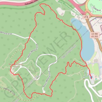
Bear Mountain Loop via Hessian Lake
Interactive map
GPS track profile
About this GPS track
Name: Bear Mountain Loop via Hessian Lake GPS track, route, trail
Coordinates: 41.30731 -74.00730 41.32187 -73.99063
Topography: Rockland County topographic map
Other GPS tracks
Click on a GPS track to view route, its statistics and profile.
Montréal - New York
Canada > Québec > Agglomération de Montréal > Montréal
Distance: 396.0 mi • Elevation gain: 13,563 ft • Maximum elevation: 988 ft