Cap2Cap 2021
Great day
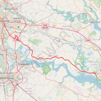
- Distance: 52.5 mi
- Elevation gain: 1,283 ft
- Maximum elevation: 167 ft
- Elevation loss: 1,296 ft
- Minimum elevation: 7 ft
- Moving time: 4 h 26 m
- Moving speed: 11.8 mph
- Maximum speed: 27.3 mph
- Total time: 4 h 59 m
- Global speed: 10.5 mph
- Date: 05/07/2021
Interactive map
GPS track profile
About this GPS track
Name: Cap2Cap 2021 GPS track, route, trail
Start: Pointe at Jamestown, James City County, Virginia, 23081, United States (37.22786 -76.78224)
Coordinates: 37.22786 -77.42127 37.52650 -76.78067
Topography: James City County topographic map