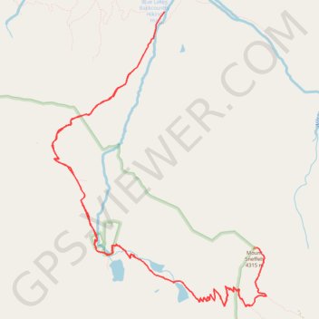
Mount Sneffels via Blue Lakes
Interactive map
GPS track profile
About this GPS track
Name: Mount Sneffels via Blue Lakes GPS track, route, trail
Start: Blue Lakes Trail, Ouray County, Colorado, United States (38.03453 -107.80724)
End: Dallas Trail, Ouray County, Colorado, United States (38.03451 -107.80727)
Coordinates: 37.99594 -107.82583 38.03453 -107.79025
Topography: Ouray County topographic map