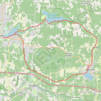
Boucle Granby-Yamaska-Waterloo en vélo
Interactive map
GPS track profile
About this GPS track
Name: Boucle Granby-Yamaska-Waterloo en vélo GPS track, route, trail
Start: Rue Denison Est, Granby, La Haute-Yamaska, Estrie, Québec, J2H 2T6, Canada (45.39561 -72.71312)
End: Rue Denison Est, Granby, La Haute-Yamaska, Estrie, Québec, J2H 2T6, Canada (45.39553 -72.71326)
Coordinates: 45.32380 -72.71326 45.42575 -72.49948
Other GPS tracks
Click on a GPS track to view route, its statistics and profile.