Tracklog
- Distance: 8.2 mi
- Elevation gain: 1,014 ft
- Maximum elevation: 1,289 ft
- Elevation loss: 1,010 ft
- Minimum elevation: 1,050 ft
Interactive map
GPS track profile
About this GPS track
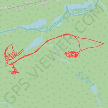
Name: Tracklog GPS track, route, trail
Start: Lac-Marguerite, Antoine-Labelle, Laurentides, Québec, Canada (47.18485 -76.08682)
End: Lac-Marguerite, Antoine-Labelle, Laurentides, Québec, Canada (47.18427 -76.08697)
Coordinates: 47.18144 -76.08710 47.18788 -76.06360
Other GPS tracks
Click on a GPS track to view route, its statistics and profile.
Tracklog
Canada > Québec > Antoine-Labelle > Lac-Marguerite
Distance: 7.3 mi • Elevation gain: 1,066 ft • Maximum elevation: 1,293 ft