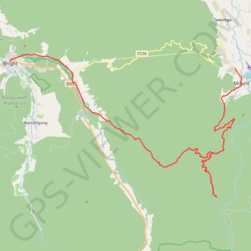
Mount Beauty - Pyramid Hill - Bright
#MTB
- Distance: 29.7 mi
- Elevation gain: 5,623 ft
- Maximum elevation: 4,505 ft
- Elevation loss: 5,801 ft
- Minimum elevation: 997 ft
Interactive map
GPS track profile
About this GPS track
Name: Mount Beauty - Pyramid Hill - Bright GPS track, route, trail
End: 80, Gavan Street, Bright, Alpine Shire, Victoria, 3741, Australia (-36.72751 146.95992)
Coordinates: -36.82174 146.95992 -36.72258 147.16215
Other GPS tracks
Click on a GPS track to view route, its statistics and profile.
Bright Moutain Bike Park
Porepunkah Plantation. #MTB #Loop #Porepunkah
Distance: 13.3 mi • Elevation gain: 1,483 ft • Maximum elevation: 1,696 ft