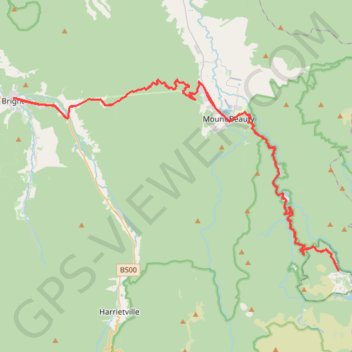
Bright - Falls Creek
Interactive map
GPS track profile
About this GPS track
Name: Bright - Falls Creek GPS track, route, trail
Start: Riverdeck Cafe, 119, Gavan Street, Bright, Alpine Shire, Victoria, Australia (-36.72679 146.96111)
End: Howitt Lane, Bright, Alpine Shire, Victoria, Australia (-36.72662 146.96120)
Coordinates: -36.86167 146.96111 -36.71239 147.27696
Other GPS tracks
Click on a GPS track to view route, its statistics and profile.
Mount Beauty - Pyramid Hill - Bright
Australia > Victoria > Mount Beauty
#MTB
Distance: 29.7 mi • Elevation gain: 5,623 ft • Maximum elevation: 4,505 ft
Bright Moutain Bike Park
Porepunkah Plantation. #MTB #Loop #Porepunkah
Distance: 13.3 mi • Elevation gain: 1,483 ft • Maximum elevation: 1,696 ft