Drummer Creek - Alfred National Park - Mallacoota
Interactive map
GPS track profile
About this GPS track
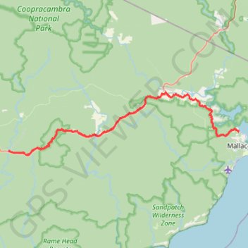
Name: Drummer Creek - Alfred National Park - Mallacoota GPS track, route, trail
Start: Drummer Track, Noorinbee, Shire of East Gippsland, Victoria, 3890, Australia (-37.56919 149.27208)
End: Mallacoota, Shire of East Gippsland, Victoria, 3892, Australia (-37.53838 149.74209)
Coordinates: -37.57627 149.27111 -37.47458 149.74268
Other GPS tracks
Click on a GPS track to view route, its statistics and profile.
Mallacoota - Tura Beach
Australia > Victoria > Mallacoota
#Bike
Distance: 75.6 mi • Elevation gain: 6,768 ft • Maximum elevation: 535 ft