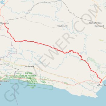
Willowmore - Jeffreys Bay
#Bike
- Distance: 140.3 mi
- Elevation gain: 11,732 ft
- Maximum elevation: 3,793 ft
- Elevation loss: 14,124 ft
- Minimum elevation: 33 ft
Interactive map
GPS track profile
About this GPS track
Name: Willowmore - Jeffreys Bay GPS track, route, trail
Coordinates: -34.03125 23.48699 -33.29384 24.92408
Other GPS tracks
Click on a GPS track to view route, its statistics and profile.