Blackborough - Sheldon - Bodmiscombe
Interactive map
GPS track profile
About this GPS track
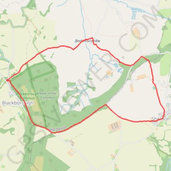
Name: Blackborough - Sheldon - Bodmiscombe GPS track, route, trail
End: Kentisbeare, Blackborough, Mid Devon, Devon, England, EX15 2HJ, United Kingdom (50.87551 -3.28860)
Coordinates: 50.86785 -3.28866 50.88174 -3.25191
Other GPS tracks
Click on a GPS track to view route, its statistics and profile.
Tour d'Europe
France > Bretagne > Finistère > Concarneau > Landan Creis
Distance: 4,432.2 mi • Elevation gain: 146,335 ft • Maximum elevation: 7,982 ft
TT22 Jo11 J9/06 : Cheddar à Plymouth Ferry Terminal
Royaume-Uni > Angleterre > Somerset > Cheddar
Distance: 166.7 mi • Elevation gain: 13,681 ft • Maximum elevation: 1,503 ft