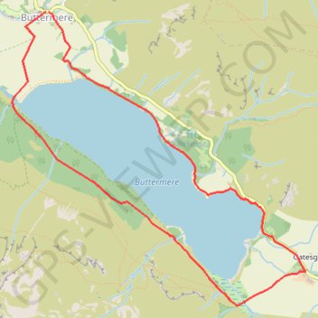
Buttermere - Lake District National Park
Interactive map
GPS track profile
About this GPS track
Name: Buttermere - Lake District National Park GPS track, route, trail
Start: B5289, Buttermere, Cumberland, England, CA13 9UZ, United Kingdom (54.54131 -3.27599)
End: B5289, Buttermere, Cumberland, England, CA13 9UZ, United Kingdom (54.54131 -3.27635)
Coordinates: 54.52159 -3.28019 54.54131 -3.24633
Other GPS tracks
Click on a GPS track to view route, its statistics and profile.
Haystack District Lake
Royaume-Uni > Angleterre > Cumberland > Buttermere > Gatesgarth
Vues superbes sur le lac de Buttermere
Distance: 4.5 mi • Elevation gain: 1,562 ft • Maximum elevation: 1,903 ft