Skeleton Gorge - Nursery Ravine
Interactive map
GPS track profile
About this GPS track
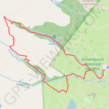
Name: Skeleton Gorge - Nursery Ravine GPS track, route, trail
Coordinates: -33.98955 18.41559 -33.97912 18.43217
Other GPS tracks
Click on a GPS track to view route, its statistics and profile.
Route von Longmarket Street nach/zu Rhodesrylaan
South Africa > Western Cape > City of Cape Town > Cape Town
Distance: 7.7 mi • Elevation gain: 489 ft • Maximum elevation: 374 ft
Simon's Town - Cape Town
South Africa > Western Cape > City of Cape Town > Simon's Town
#Bike
Distance: 33.5 mi • Elevation gain: 3,698 ft • Maximum elevation: 604 ft