Import a GPX file

Falls Creek Loop

Alpine National Park. #Hike #Loop #Alpine

  • Distance: 27.2 mi
  • Elevation gain: 6,545 ft
  • Maximum elevation: 6,030 ft
  • Elevation loss: 6,276 ft
  • Minimum elevation: 3,481 ft

Interactive map

GPS track profile

About this GPS track
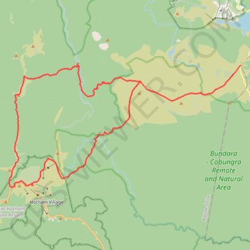
Other GPS tracks

Click on a GPS track to view route, its statistics and profile.

Mount Hotham - Mount Bogong

Australia > Victoria > Mount Hotham Alpine Resort > Hotham Village

Alpine National Park. #Hike #Alpine

Distance: 38.8 mi • Elevation gain: 7,251 ft • Maximum elevation: 6,509 ft

Tour of High Plains

Australia > Victoria > Falls Creek Alpine Resort > Falls Creek

Rocky Valley Storage. Alpine Natural Park. #MTB #Loop #Alpine

Distance: 35.8 mi • Elevation gain: 3,514 ft • Maximum elevation: 5,804 ft

Hotham Loop

Australia > Victoria > Mount Hotham Alpine Resort > Hotham Village

Alpine National Park. #Hike #Loop #Alpine

Distance: 23.7 mi • Elevation gain: 6,194 ft • Maximum elevation: 6,286 ft

Bright - Hotham Heights

Australia > Victoria > Bright

Alpine National Park. #Bike #Alpine

Distance: 68.3 mi • Elevation gain: 10,974 ft • Maximum elevation: 6,030 ft