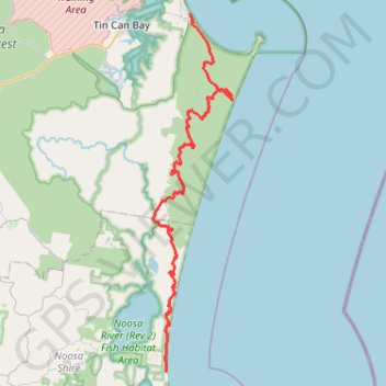
GPS tracks, routes, trails, hikes

GPS tracks visualization and sharing, free and without registration.

Import a GPX file

Cooloola Great Walk

Great Sandy National Park. #Hike #Sandy

  • Distance: 54.7 mi
  • Elevation gain: 6,329 ft
  • Maximum elevation: 699 ft
  • Elevation loss: 6,296 ft
  • Minimum elevation: 3 ft

Interactive map

GPS track profile

About this GPS track

Name: Cooloola Great Walk GPS track, route, trail.
Start: Cooloola Great Walk, Noosa North Shore, Noosa Shire, Queensland, 4565, Australia (-26.32992 153.06053)
End: Phil Rogers Park, Wide Bay Esplanade, Rainbow Beach, Gympie Regional, Queensland, 4581, Australia (-25.90253 153.09277)
Coordinates: -26.32993 153.04349 -25.90253 153.14952

Other GPS tracks

Mount Seawah - Lake Cootharaba

Australia > Queensland

Great Sandy National Park. #Hike #Sandy

Distance: 5.8 mi - Elevation gain: 499 ft - Maximum elevation: 272 ft - Coordinates: -26.32990 153.05977 -26.26063 153.06599

Start: 3rd Cutting (vehicle access to beach, north only), Noosa North Shore, Noosa Shire, Queensland, Australia (-26.32990 153.06065)

End: Mount Seawah Lookout, Mt Seawah Track, Noosa North Shore, Noosa Shire, Queensland, Australia (-26.26212 153.06176)

Rainbow Beach - Double Island Point

Australia > Queensland > Rainbow Beach

Great Sandy National Park. #MTB #Loop #Sandy

Distance: 27.6 mi - Elevation gain: 2,408 ft - Maximum elevation: 666 ft - Coordinates: -26.00561 153.08975 -25.89975 153.19070

Start: FoodWorks, 4, Rainbow Beach Road, Rainbow Beach, Gympie Regional, Queensland, 4581, Australia (-25.90188 153.09195)