Import a GPX file

Falls Creek - Aqueduct Trail - Wishing Well - Flowtown - Packhorse Trail

#MTB #Loop

  • Distance: 10.6 mi
  • Elevation gain: 2,014 ft
  • Maximum elevation: 5,289 ft
  • Elevation loss: 2,041 ft
  • Minimum elevation: 4,088 ft

Interactive map

GPS track profile

About this GPS track

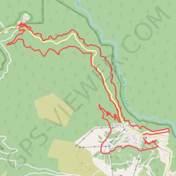
Name: Falls Creek - Aqueduct Trail - Wishing Well - Flowtown - Packhorse Trail GPS track, route, trail

Start: Falls Creek Resort, Slalom Plaza, Falls Creek, Falls Creek Alpine Resort, Victoria, Australia (-36.86397 147.28163)

End: Bogong High Plains Road, Falls Creek, Falls Creek Alpine Resort, Victoria, Australia (-36.86347 147.28139)

Coordinates: -36.86705 147.24846 -36.84172 147.28767

Other GPS tracks

Click on a GPS track to view route, its statistics and profile.

Mount Hotham - Mount Bogong

Australia > Victoria > Mount Hotham Alpine Resort > Hotham Village

Alpine National Park. #Hike #Alpine

Distance: 38.8 mi • Elevation gain: 7,251 ft • Maximum elevation: 6,509 ft

Tour of High Plains

Australia > Victoria > Falls Creek Alpine Resort > Falls Creek

Rocky Valley Storage. Alpine Natural Park. #MTB #Loop #Alpine

Distance: 35.8 mi • Elevation gain: 3,514 ft • Maximum elevation: 5,804 ft

Bright - Falls Creek

Australia > Victoria > Bright

Alpine National Park. #Bike #Alpine

Distance: 74.9 mi • Elevation gain: 14,344 ft • Maximum elevation: 4,951 ft