Wooroi
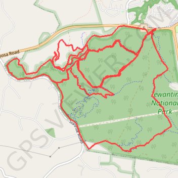
Interactive map
GPS track profile
About this GPS track
Name: Wooroi GPS track, route, trail
Start: Cooroy - Noosa Road, Tewantin, Noosa Shire, Queensland, 4565, Australia (-26.39924 153.01022)
End: Wooroi Track, Tewantin, Noosa Shire, Queensland, 4565, Australia (-26.39945 153.01026)
Coordinates: -26.41889 152.98366 -26.39879 153.01299
Other GPS tracks
Click on a GPS track to view route, its statistics and profile.
Tinbeerwah - Tewantin National Park - Ringtail State Forest
Australia > Queensland > Tewantin
#MTB #Loop #Tinbeerwah #Tewantin #Ringtail
Distance: 30.3 mi • Elevation gain: 2,320 ft • Maximum elevation: 719 ft