Piarere - Mangakino
Interactive map
GPS track profile
About this GPS track
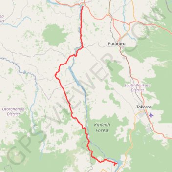
Name: Piarere - Mangakino GPS track, route, trail
Start: Horahora Road, South Waikato District, Waikato, New Zealand (-37.95264 175.66614)
End: 44, Moana Crescent, Mangakino, Taupō District, Waikato, 3421, New Zealand (-38.36662 175.77765)
Coordinates: -38.37136 175.57301 -37.95264 175.78033
Other GPS tracks
Click on a GPS track to view route, its statistics and profile.