Tongariro - Pipiriki
Interactive map
GPS track profile
About this GPS track
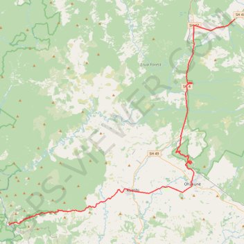
Name: Tongariro - Pipiriki GPS track, route, trail
Coordinates: -39.47881 175.04124 -39.16765 175.48277
Other GPS tracks
Click on a GPS track to view route, its statistics and profile.
Blyth Hut
New Zealand > Manawatū-Whanganui > Ruapehu District > Turoa Village
19-JUN-07
Distance: 15.2 mi • Elevation gain: 2,776 ft • Maximum elevation: 5,669 ft