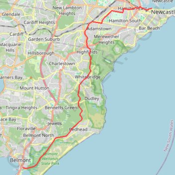
Fernleigh Rail Trail
#Bike
- Distance: 13.1 mi
- Elevation gain: 525 ft
- Maximum elevation: 322 ft
- Elevation loss: 541 ft
- Minimum elevation: -3 ft
Interactive map
GPS track profile
About this GPS track
Name: Fernleigh Rail Trail GPS track, route, trail
Coordinates: -33.03927 151.66094 -32.92365 151.77083
Other GPS tracks
Click on a GPS track to view route, its statistics and profile.
Teralba - Newcastle
Australia > New South Wales > Newcastle-Maitland
#Hike
Distance: 15.8 mi • Elevation gain: 1,191 ft • Maximum elevation: 351 ft
Broadmeadow - Readhead Beach - Belmont
Australia > New South Wales > Newcastle-Maitland
Fernleigh Track. #Bike
Distance: 22.8 mi • Elevation gain: 866 ft • Maximum elevation: 322 ft