Turramurra - Macquarie University
#Hike
- Distance: 4.8 mi
- Elevation gain: 341 ft
- Maximum elevation: 564 ft
- Elevation loss: 712 ft
- Minimum elevation: 79 ft
Interactive map
GPS track profile
About this GPS track
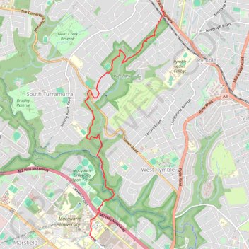
Name: Turramurra - Macquarie University GPS track, route, trail
Coordinates: -33.77728 151.11622 -33.73585 151.13320
Other GPS tracks
Click on a GPS track to view route, its statistics and profile.
Perth to Sydney
Australie > Australie occidentale > City of Belmont
Distance: 2,362.0 mi • Elevation gain: 47,762 ft • Maximum elevation: 3,802 ft